-
Mt. Bierstadt Group Summit - Front Range, Colorado
-
A rest before the summit push on Dallas Peak - San Juan Range, Colorado
-
Broken Ankle + 6 Miles = Tired
-
The classic San Juan approach - San Juan Range, Colorado
-
Overlooking Noname Basin from Twin Thumbs Pass - San Juan Range, Colorado
-
Upper Noname Basin - San Juan Range, Colorado
-
Nearing Noname Cabin - San Juan Range, Colorado
-
Twin Thumbs Twins - San Juan Range, Colorado
-
Nearing the summit of Pt. 13,736 - Sawatch Range, Colorado
-
Blustery day on Iowa Peak - Sawatch Range, Colorado
-
Morning snow at 15k, Cerro Ramada - Cordillera Ramada
-
Artesonraju from the summit of Nevado Pisco - Cordillera Blanca, Peru
-
February crowds on Gray's Peak - Front Range, Colorado
-
Kicking steps on Cerro Lliani - Cordillera Vilcanota, Peru
-
Final traverse to the summit of Wheeler Mountain - Ten Mile Range, Colorado
-
The long walk to Pachanta - Cordillera Vilcanota, Peru
- banner31
Afternoon at 17k on Cerro Ramada - Cordillera Ramada, Argentina
- banner22
The final ridge on Iowa Peak - Sawatch Range, Colorado
-
Summer summit on Longs Peak - Front Range, Colorado
-
A rest day at the Pachanta Hot Springs - Cordillera Vilcanota, Peru
-
Mind over matter on Mt. Parnassas - Front Range, Colorado
-
Rest stop on Cerro Lliani - Cordillera Vilcanota, Peru
- banner30
Post nap surprise on Cerro Ramada - Cordiller Ramada, Argentina
-
Summit on Cerro Lliani - Cordillera Vilcanota, Peru
- banner23
Ridge walking on Grizzly Peak - Sawatch Range, Colorado
-
Enroute the summit via the West Ridge on Pacific Peak - Ten Mile Range, Colorado
-
Mule train bound for Chilca - Cordillera Vilcanota, Peru
-
Taking in the view from Fletcher Peak - Ten Mile Range, Colorado
-
Hiking on Silverheels - Mosquito Range, Colorado
-
Traversing! Gladstone Peak - San Juan Range, Colorado
- banner24
The best of times at Willow Lake - Sangre de Christo Range, Colorado
- banner29
High Altitude Cerebral Edema? - Cordillera Ramada, Argentina
-
Bound for Chilca - Vilcanota Range, Peru
-
Going alpine light, Holy Cross Ridge - Sawatch Range, Colorado
-
Cumbre! Campa I - Cordillera Vilcanota, Peru
-
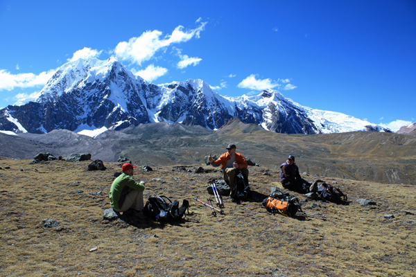
Roadside lunch with the best of company - Cordillera Vilcanota, Peru
- banner25
Long ridge walk to the summit of California Peak - Sangre de Christo Range, Colorado
- banner28
Crossing el Rio Colorado . . . in the afternoon - Cordillera Ramada, Argentina
- banner37
Dealing with Fall snows high on Casco Peak - Sawatch Range, Colorado
-
Moonrise over Mercedario - Cordillera Ramada, Argentina
-
Still climbing at 20,900 on Cerro Ramada - Cordiller Ramada, Argentina
-
Talus on Halo Ridge, Mt. of the Holy Cross - Sawatch Range, Colorado
- banner26
Deteriorating conditions on Mt. Arkansas - Ten Mile Range, Colorado
- banner27
After the climb - Cordillera Ramada, Argentina
- banner38
Taking in the view from the summit of Crystal Peak - Tenmile Range, Colorado
-
Topping out on Mt. Arkansas' North Couloir - Mosquito Range, Colorado
-
Glissade on Mt. Arkansas - Mosquito Range, Colorado
-
Hard snow morning on Teakettle Mountain - San Juan Range, Colorado
-
Spring snow announces the start of the climb on Dallas Peak - San Juan Range, Colorado
-
Crossing the Eolus Catwalk - San Juan Range, Colorado

 We had no particular need to get going early but breakfast was on the table at 7:00 with the group tents falling as we ate. I think that after 4 nights at Pachaspata, we were all ready for some new scenery and the crew was especially antsy to do something other than just hang out and wait for us to tire of this location. We broke our individual tents down, packed the duffle bags and put what we might need for the day's hike in our packs. We only had to cover about six miles and the first two of them were quite familiar from our prior recon and climb of Nevado Campa.
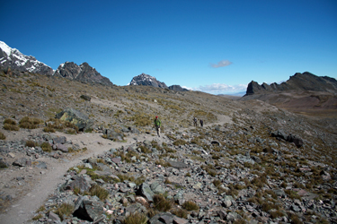 We started for Campa Pass and soon met with the now anticipated squall of some Andean bird that seemed to take predictable offence at our crossing through its territory. We walked on, our group stretching out as our speed varied with lingering fatigue from the day before and the remnants of stomach issues that were still clinging here and there. We each hiked at our own pace, knowing that we'd reform at the pass before heading down the other side. The route was really pretty this day as we enjoyed bright blue skies and the icy bulk of the 5800m peaks that formed the valley opposite Nevada Campa.
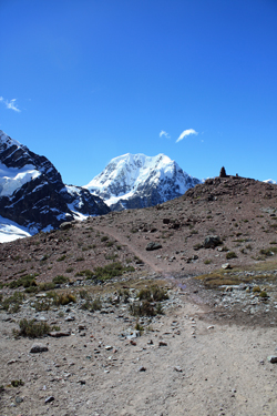 We held up at the pass, taking a brief stop to chat with a one Italian & two Peruvian & two mule group headed toward Pachaspata and then out via Tinqui. This fellow had made a quick solo of Campa that morning and his arrieros had just caught up for the downhill portion of their day. We ate some of our "box lunch" and then hefted the packs to start the downhill leg to Jampa. The top of the pass provided a few rolling up and down segments but there was no doubt that this pass, our last one from the trekking perspective, would bring the "uphill" portion of the trek to a close. We intentionally chose is one wasy route as it offered but this one high pass between the start and finish points . . . a far cry from our up and down Apolobamba experience where a "Campa Pass" equivalent could be expected to occur no less than 2 or 3 times on a long trekking day.
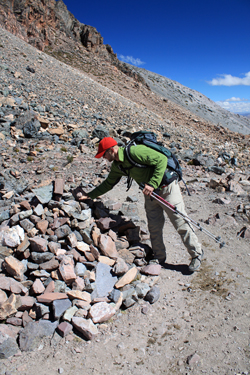 overall . . . a little nod to Pachamama when in her neighborhood surely cannot hurt. We passed through the cairn jungle for perhaps a quarter mile before the trail started down for good. We were now in the upper Rio Chillcamaya Valley with its incredible views of the ice fields that filled in the upper reaches of the valley along the flanks Nevado Jatumpampa and the other surrounding 5800 and 6000 meter peaks to the north. We could also now see Nevado Huayruro Punca, the 5500m peak that we anticipated climbing from the Jampa camp.
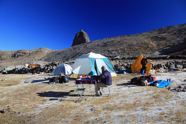
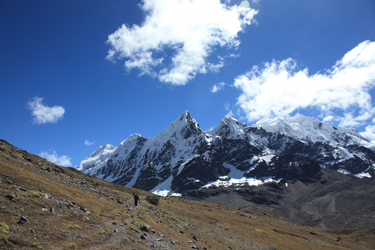 Leo and Rocque passed with the pack train and stopped to inquire if we wanted to camp at Jampa proper or stop about a mile short of the hamlet in a more secluded area. We chose the stop short option and the horses were soon again on the move. We hiked another two miles and came to the adjusted Jampa camp spot, which was located on a flat where the local campesinos had constructed a number of alpaca dung silos. These ten to fifteen foot high conical structures resemble a beehive kiln like those constructed in the western U.S. one hundred years ago for the production of charcoal. Here, the structures serve to store alpaca dung out of the wet so that it can dry and be readily accessible for fuel. The silos are made of blocks of sod that are cut from the ground surrounding the silo which are stacked igloo style to result in the tapered form.
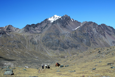 The crew had the group tents up in no time and we got the personal camp in order at about the same pace. Domingo made an afternoon snack and then another dinner while we rested up and wandered about the area trying to gain the best views of the surrounding peaks. Our plan to climb Huayruro Punca fell by the wayside as we gained a more first hand perspective as to the distance from our camp to even the base of the climb. A climb of Huayruro Punca would have a very long approach up a valley that did not boast a substantive trail. None of us really wanted to cover 8 miles above 15k just to get to and from the climb. Instead we settled on a climb of 17,850 foot Cerro Lliani, which resembled a Colorado Elk Range 14'er with a bit of
 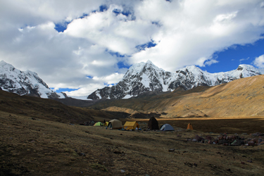 snow on top. We knew that bit of snow would be a substantial snowfield but the peak looked like a close in full day climb where climb would be the operative word rather than hike.