-
Mt. Bierstadt Group Summit - Front Range, Colorado
-
A rest before the summit push on Dallas Peak - San Juan Range, Colorado
-
Broken Ankle + 6 Miles = Tired
-
The classic San Juan approach - San Juan Range, Colorado
-
Overlooking Noname Basin from Twin Thumbs Pass - San Juan Range, Colorado
-
Upper Noname Basin - San Juan Range, Colorado
-
Nearing Noname Cabin - San Juan Range, Colorado
-
Twin Thumbs Twins - San Juan Range, Colorado
-
Nearing the summit of Pt. 13,736 - Sawatch Range, Colorado
-
Blustery day on Iowa Peak - Sawatch Range, Colorado
-
Morning snow at 15k, Cerro Ramada - Cordillera Ramada
-
Artesonraju from the summit of Nevado Pisco - Cordillera Blanca, Peru
-
February crowds on Gray's Peak - Front Range, Colorado
-
Kicking steps on Cerro Lliani - Cordillera Vilcanota, Peru
-
Final traverse to the summit of Wheeler Mountain - Ten Mile Range, Colorado
-
The long walk to Pachanta - Cordillera Vilcanota, Peru
- banner31
Afternoon at 17k on Cerro Ramada - Cordillera Ramada, Argentina
- banner22
The final ridge on Iowa Peak - Sawatch Range, Colorado
-
Summer summit on Longs Peak - Front Range, Colorado
-
A rest day at the Pachanta Hot Springs - Cordillera Vilcanota, Peru
-
Mind over matter on Mt. Parnassas - Front Range, Colorado
-
Rest stop on Cerro Lliani - Cordillera Vilcanota, Peru
- banner30
Post nap surprise on Cerro Ramada - Cordiller Ramada, Argentina
-
Summit on Cerro Lliani - Cordillera Vilcanota, Peru
- banner23
Ridge walking on Grizzly Peak - Sawatch Range, Colorado
-
Enroute the summit via the West Ridge on Pacific Peak - Ten Mile Range, Colorado
-
Mule train bound for Chilca - Cordillera Vilcanota, Peru
-
Taking in the view from Fletcher Peak - Ten Mile Range, Colorado
-
Hiking on Silverheels - Mosquito Range, Colorado
-
Traversing! Gladstone Peak - San Juan Range, Colorado
- banner24
The best of times at Willow Lake - Sangre de Christo Range, Colorado
- banner29
High Altitude Cerebral Edema? - Cordillera Ramada, Argentina
-
Bound for Chilca - Vilcanota Range, Peru
-
Going alpine light, Holy Cross Ridge - Sawatch Range, Colorado
-
Cumbre! Campa I - Cordillera Vilcanota, Peru
-
Roadside lunch with the best of company - Cordillera Vilcanota, Peru
- banner25
Long ridge walk to the summit of California Peak - Sangre de Christo Range, Colorado
- banner28
Crossing el Rio Colorado . . . in the afternoon - Cordillera Ramada, Argentina
- banner37
Dealing with Fall snows high on Casco Peak - Sawatch Range, Colorado
-
Moonrise over Mercedario - Cordillera Ramada, Argentina
-
Still climbing at 20,900 on Cerro Ramada - Cordiller Ramada, Argentina
-
Talus on Halo Ridge, Mt. of the Holy Cross - Sawatch Range, Colorado
- banner26
Deteriorating conditions on Mt. Arkansas - Ten Mile Range, Colorado
- banner27
After the climb - Cordillera Ramada, Argentina
- banner38
Taking in the view from the summit of Crystal Peak - Tenmile Range, Colorado
-
Topping out on Mt. Arkansas' North Couloir - Mosquito Range, Colorado
-
Glissade on Mt. Arkansas - Mosquito Range, Colorado
-
Hard snow morning on Teakettle Mountain - San Juan Range, Colorado
-
Spring snow announces the start of the climb on Dallas Peak - San Juan Range, Colorado
-
Crossing the Eolus Catwalk - San Juan Range, Colorado

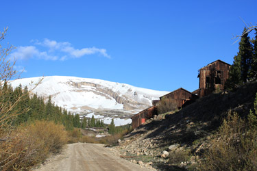 Horseshoe Mountain is hard to miss if you have been up Sherman from the Fairplay side as Horseshoe's impressive cirque stares you in the face for much of the last portion of the drive. I'd not given much thought to climbing Horseshoe but since I had a weekend to kill, I thought I'd spend it climbing some of the peaks that I'd just not given serious consideration before.
  The road to the Leavick trail head was open and I parked at a wide spot just down and around the curve from the gate. I chatted with a fellow originally from Oregon, now of Colorado, about the route to Sherman and Gemini and mentioned that I was off in the other direction to Peerless and Horseshoe. I looked at the map, justified not starting at the lower elevation to do the classic road march, and instead opted for a more cross country route to nab Peerless then Horseshoe. The weather was nice, the skies were mostly blue . . . but those few clouds that were there, well, they were screaming across the sky.
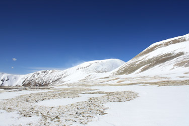 I skirted the gate and wandered on up to the first set of mine ruins, took the left hand turn and followed the old mine road across a small snow field and then on around the curve. Once around the curve, I found that the basin below Peerless was mostly snow and that the snow was nicely frozen. I picked a snowfield route and stopped to put on my crampons. The ascent up the snow field was on hard frozen snow with not a single post hole for the whole of the climb. The climb of course landed me not on the summit of Peerless but at the crest of an upper basin that held the summit pyramid of Peerless, the ruins of the Peerless mine and a traverse toward Horseshoe. I was also hit with the wind, not too bad, but enough to make me give Peerless second thoughts and decide to just traverse across its base to the start of the ridge up Horseshoe.
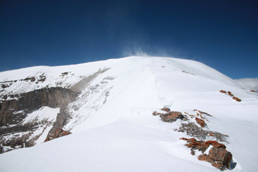 The traverse across the base of Peerless to the start point of the Horseshoe ridge was more or less flat but as soon as I broke into the saddle between Peerless and Horseshoe, the wind hit me for everything it was worth. The forecast told of 20 to 30 mph winds but the nearly continuous gusts were likely hitting the 60 mph mark. I live in Cheyenne and the wind that day easily measured up to Wyoming standards. A hiking pole held by the lanyard would hold steady at 45 degrees and I could lean hard into the wind without a problem. I kept the crampons on as without them I'd have been blown down for sure . . . it was bad enough getting pushed three and four steps sideways every few seconds. I stayed low, hugged every spot of topographic relief available and made my way to the ridge to start the climb of Horseshoe. I wasn't sweating getting tossed into the cirque as I made sure I stayed well away from the edge of the ridge, as in a good bit downhill from the edge.
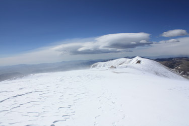 I made steady progress up the ridge and enjoyed a break from the wind here and there, but by the time I got to the last short climb before the summit flat, I was about to call it quits, yes, call it that close. The load of snow and ice crystals carried by the wind had just about fried one cheek and though it was not that cold, the abrasive sting was doing a job on me. I'm talking about even with the hood up and the head cocked. Visibility was on and off and the leather side pieces on the glacier glasses were unable to stop the sting of the blowing ice. This clearly had become a goggle climb, and as the old saying goes . . . I'd brought a knife to a gun fight. I trudged to the summit and walked a bit further to get in the lee of the old structure on the far side of the summit. Though totally filled with snow, I did manage to find one small snow free nook where I could shoot a Goo and take a sip before going back down.
 I braced myself for the exit from the welcome wind shadow and then made my way back across the summit flat and on back down the northern ridge. When I was about half way down the ridge, the wind abated a bit and I stopped to take some photos, shoot another Goo and take a sip. My real goal was to get back down below the elevation of the Peerless/Horseshoe saddle where the wind would again be broken by the terrain. I retraced my ascent route, skirted the base of Peerless and dropped into the lower basin, heel stepping on down the snowfield that was well frozen a few hours before but which now gave me the opportunity to practice my post holing technique. Soon enough however, I dropped back onto the mine road and was back at the truck, only about 4 hours after starting.