Mount Bierstadt
December 13, 2009 (attempt) & January 2, 2010 (summit) - West Ridge from Guanella Pass
The December 13th Attempt . . .
. . . Argentina . . . less than four weeks off . . . and the weather forecast called for some challenging conditions. We weren't really looking for a summit but more for an opportunity to just get out, get some elevation and get a bit more cold before our upcoming trip south. The winds had been whipping the previous week's snow around and I felt that Bierstadt would provide just the opportunity to reach 14k on a generally safe route with little avalanche danger. We got all of that in spades.
 Bob and I met at my place at 5 a.m. and we were hopeful that the wind buffeting the truck as we headed south on I-25 was just the typical Wyoming breeze and not an indicator of more to come once we got to Colorado. As is usually the case, the wind let up as we crossed the Colorado border and we made good time through Denver and then on up to Bailey and Grant, on what were now wet roads. However, we had to take the back way to Guanella Pass as the regular route was closed due to a rock fall and the onset of winter. However, the approach from the South Platte side was still open to a gate just two miles shy of the pass. Bob and I met at my place at 5 a.m. and we were hopeful that the wind buffeting the truck as we headed south on I-25 was just the typical Wyoming breeze and not an indicator of more to come once we got to Colorado. As is usually the case, the wind let up as we crossed the Colorado border and we made good time through Denver and then on up to Bailey and Grant, on what were now wet roads. However, we had to take the back way to Guanella Pass as the regular route was closed due to a rock fall and the onset of winter. However, the approach from the South Platte side was still open to a gate just two miles shy of the pass.
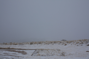
 We encountered snow at just about the time we cut off US 285 and it became a regular snow storm by the time we parked just shy of the winter closure, about ten miles up from the highway. The road all the way to the gate was easily driven in a Toyota Tacoma . . . with the aid of 4WD to keep things predictable. We parked shy of the gate and looked at the snow shoes in the bed of the truck . . . to take or not to take . . . we left them in the bed and figured that the road would offer deep spots but also some blow offs along the edges. But for a spot or two where the guard rails instigated drifting, we hiked through no more than about 8 to 10 inches of fresh powder. It probably took an hour or so to hike to Guanella Pass proper, after which we figured there would be a beaten track through the willows. We encountered snow at just about the time we cut off US 285 and it became a regular snow storm by the time we parked just shy of the winter closure, about ten miles up from the highway. The road all the way to the gate was easily driven in a Toyota Tacoma . . . with the aid of 4WD to keep things predictable. We parked shy of the gate and looked at the snow shoes in the bed of the truck . . . to take or not to take . . . we left them in the bed and figured that the road would offer deep spots but also some blow offs along the edges. But for a spot or two where the guard rails instigated drifting, we hiked through no more than about 8 to 10 inches of fresh powder. It probably took an hour or so to hike to Guanella Pass proper, after which we figured there would be a beaten track through the willows.
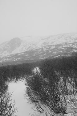
We cut off the road and waded down through two feet of snow to reach the trench that holds the summer trail. Once in the trench proper, the snow was either boot tracked, blown out or just plain shallow enough that snow shoes were not needed. But now that we were out in the relative open, the winds were driving the snow along a horizontal course and we were starting to get pelted here and there by ice 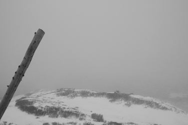 pellets. However, we had little trouble finding the proper course and crossed Gomer Creek on a pair of logs that were surrounded by muddy slushy ice, not the hard freeze that I expected. Once across the creek, I noted to Bob that we had first to climb a gentle slope before taking on a steeper climb up the headwall that guards the wide open expanse of Bierstadt proper. pellets. However, we had little trouble finding the proper course and crossed Gomer Creek on a pair of logs that were surrounded by muddy slushy ice, not the hard freeze that I expected. Once across the creek, I noted to Bob that we had first to climb a gentle slope before taking on a steeper climb up the headwall that guards the wide open expanse of Bierstadt proper.
The trail up the headwall was not blown clear but it was blown shallow enough to still preclude the need for snow shoes. We cut left and right through the lower switchbacks and then on up and over the bluff proper. Then the wind got serious . . .
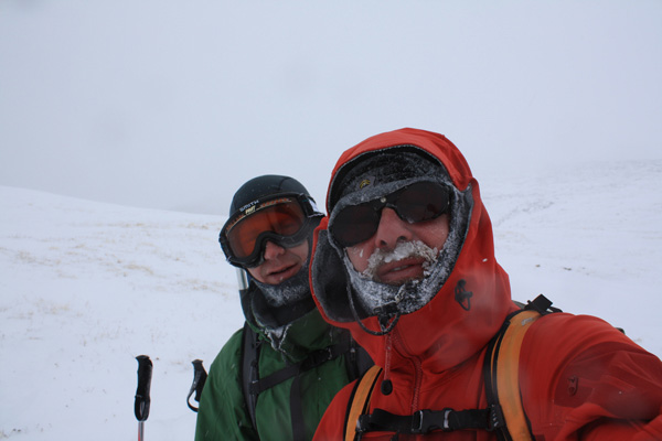
 The wide flank of the peak was being swept by a much stronger wind, more than well laden with sharp ice pellets and spindrift. The balaclava covered much of my face but any exposed part was stung by the needle sharp wind as I recalled a trip a few years earlier when similar conditions resulted in a case of frost bite for one of our group. I'd also been marking points on my GPS as a just in case, but I'm not one to use the GPS as an intentional means of retreating back to known territory. The wide flank of the peak was being swept by a much stronger wind, more than well laden with sharp ice pellets and spindrift. The balaclava covered much of my face but any exposed part was stung by the needle sharp wind as I recalled a trip a few years earlier when similar conditions resulted in a case of frost bite for one of our group. I'd also been marking points on my GPS as a just in case, but I'm not one to use the GPS as an intentional means of retreating back to known territory.
So there we were, the winds were likely doing 30 to 40 mph, the temp is in the single digits and the visibility has just gone to 50 or 75 feet. That was it, we scored the cold we were after, a few miles above tree line, and a bit more acclimatization for the high Andes. We did not need to mess around with bad visibility to boot. We turned 180 degrees and followed our rapidly eroding tracks back to the Guanella Pass road, which now showed but a trace of our in morning track, and on back down the road to the truck.
The January 2nd Summit . . .
In December, we struck out on scoring the summit of Bierstadt. In hindsight, the conditions that turned us around on December 13th were not that much different than those we encountered on this climb, but for a few more weeks of winter to convince us the cold and wind were just was not that bad.
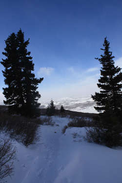
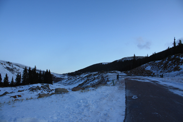 We left Cheyenne at 4 a.m.and were out of the truck and hiking up an a dry road to Guanella Pass by 7:30. Although the gate was closed, there seemed little doubt the road had been plowed recently, due to the snow pushed up along the sides and the complete absence of any drifting on the road whatsoever. We were both lugging snow shoes on our packs as we figured that the foot of snow that we suffered through three weeks before would be even deeper and we would need the shoes for sure. We hoofed the mile and half to the pass with little effort under blue skies . . . we knew we had a bluebird day coming regardless of the forecast of a bit of snow coming in from Utah. That was until we stepped off the road to start the climb proper. We left Cheyenne at 4 a.m.and were out of the truck and hiking up an a dry road to Guanella Pass by 7:30. Although the gate was closed, there seemed little doubt the road had been plowed recently, due to the snow pushed up along the sides and the complete absence of any drifting on the road whatsoever. We were both lugging snow shoes on our packs as we figured that the foot of snow that we suffered through three weeks before would be even deeper and we would need the shoes for sure. We hoofed the mile and half to the pass with little effort under blue skies . . . we knew we had a bluebird day coming regardless of the forecast of a bit of snow coming in from Utah. That was until we stepped off the road to start the climb proper.
 The first squall blew in fast from behind and within just a minute or two, Bierstadt was gone, Spalding was gone, Squaretop was gone and we could barely see the willows and nothing of the climb beyond. I did not have the heart to say what was going through my mind . . . "here we go again, a repeat of the last climb for sure." I've been at this climbing gig long enough to know that, at least for me, a true winter summit carries about a 1 in 3 or 4 chance of coming to fruition on any given attempt. You hope for a summit but the weather tends to turn us around when it really comes in. Last time, we turned at the top of the headwall and I really figured that this trip would be little more than another exercise in physical conditioning. The first squall blew in fast from behind and within just a minute or two, Bierstadt was gone, Spalding was gone, Squaretop was gone and we could barely see the willows and nothing of the climb beyond. I did not have the heart to say what was going through my mind . . . "here we go again, a repeat of the last climb for sure." I've been at this climbing gig long enough to know that, at least for me, a true winter summit carries about a 1 in 3 or 4 chance of coming to fruition on any given attempt. You hope for a summit but the weather tends to turn us around when it really comes in. Last time, we turned at the top of the headwall and I really figured that this trip would be little more than another exercise in physical conditioning.
 However, then something magical happened .. . we both decided that we would make use of the crapper at the pass . . . and, even though just seconds before I'd been the beneficiary of a cold breeze from below, when we exited our respective sides, the air was still . . . dead still. This was a sign, a sign we both wanted to believe foretold a change for the better and a hope for the first summit of 2010. We were off through the willows, walking the well compacted boot and snow shoe track put in by others before is. When I say boot track, I mean a compacted trough of Rainier Disappointment Cleaver boot track proportions. Stay on center and not a posthole to worry about but for a drifted section or two. However, I was not about to stash the snow shoes because I knew that as long as I carried their extra weight, I would not need them. However, then something magical happened .. . we both decided that we would make use of the crapper at the pass . . . and, even though just seconds before I'd been the beneficiary of a cold breeze from below, when we exited our respective sides, the air was still . . . dead still. This was a sign, a sign we both wanted to believe foretold a change for the better and a hope for the first summit of 2010. We were off through the willows, walking the well compacted boot and snow shoe track put in by others before is. When I say boot track, I mean a compacted trough of Rainier Disappointment Cleaver boot track proportions. Stay on center and not a posthole to worry about but for a drifted section or two. However, I was not about to stash the snow shoes because I knew that as long as I carried their extra weight, I would not need them.
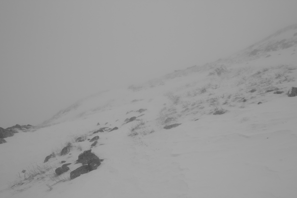
 The crossing of the creek was easy as it was solidly frozen as compared to the muddy mush we crossed on a pair of spindly poles weeks before. The trail on the other side was icy for about 50 feet, icy enough for me to take a tumble and end up in my butt in the snow. Then we were on our way, wending our way through the switchbacks before the headwall and then on up through the headwall to the flank of the mountain proper. The summer trail was drifted over but for the first quarter mile after surmounting the headwall, it was easily discernable to a practiced eye. Once the slope began to steepen, we left the trail behind and aimed to connect shallow wind hammered snow fields to avoid any post holing and gain the base of the larger talus covered slope that guards the ridge proper. The crossing of the creek was easy as it was solidly frozen as compared to the muddy mush we crossed on a pair of spindly poles weeks before. The trail on the other side was icy for about 50 feet, icy enough for me to take a tumble and end up in my butt in the snow. Then we were on our way, wending our way through the switchbacks before the headwall and then on up through the headwall to the flank of the mountain proper. The summer trail was drifted over but for the first quarter mile after surmounting the headwall, it was easily discernable to a practiced eye. Once the slope began to steepen, we left the trail behind and aimed to connect shallow wind hammered snow fields to avoid any post holing and gain the base of the larger talus covered slope that guards the ridge proper.
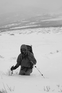
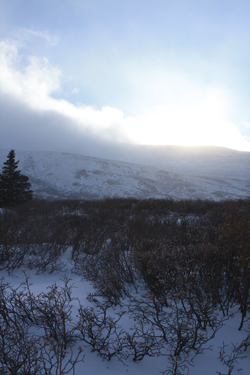
We covered all of the easy ground under partly cloudy skies that had cleared from the creek crossing to the base of the talus. Then squall number 2 arrived and stayed. The top of the peak disappeared into the clouds, the Sawtooth fell victim next and then the visibility dropped to a few hundred feet. 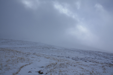 I'd been on the peak multiple times and had a solid feel for the contours and descent route from the notch in the ridge that guards the final climb to the summit. Drop the shallow couloir, contour the drop into Bierstadt/Sawtooth chasm, score trail and return to pass. I'd also augmented my direction finding with a warm GPS in my pocket and my points from three weeks prior. We only needed a few hundred vertical to summit and we were both up for continuing the climb. I'd been on the peak multiple times and had a solid feel for the contours and descent route from the notch in the ridge that guards the final climb to the summit. Drop the shallow couloir, contour the drop into Bierstadt/Sawtooth chasm, score trail and return to pass. I'd also augmented my direction finding with a warm GPS in my pocket and my points from three weeks prior. We only needed a few hundred vertical to summit and we were both up for continuing the climb.
We worked our way through the talus, leaving a solid trail through well connected snow segments, but knowing that the winds would likely remove most traces of a our ascent by the time we descended. We scored the small, pre summit climb cleft and trended to the climber's right side, keeping to the boulders but right at the edge of the snowfield . . . no point in tempting a possibly tender slope. Pachamama 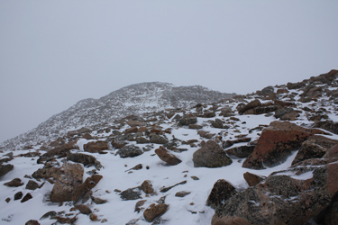 made it clear that we would work for this summit and her weather redoubled its effort to remind us of the temperamental nature of any winter climb. We intentionally climbed the final 1500 of vertical without stopping, albeit using a rest step, so we were ready for a break. We reached the summit and took that break, all of about 12 seconds as I shot a photo or two of Bob, put the camera away and suggested that we take advantage of the visibility we had and make for lower ground. made it clear that we would work for this summit and her weather redoubled its effort to remind us of the temperamental nature of any winter climb. We intentionally climbed the final 1500 of vertical without stopping, albeit using a rest step, so we were ready for a break. We reached the summit and took that break, all of about 12 seconds as I shot a photo or two of Bob, put the camera away and suggested that we take advantage of the visibility we had and make for lower ground.
We dropped from the summit cone and as I anticipated, there was no trace our our path upward. No problem, the topography would set the course, we dropped the couloir a few hundred feet, trended westerly, kept the ridge proper to our 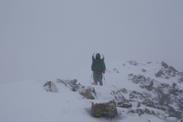 descending left and hardened the contouring effort when we encountered steeper ground. We held some distance between us and dropped to the base of the talus. We were now at the top of our connected snowfields and once again, these shallow wind hammered sections provided an efficient path to the mellow ground and summer trail below. We next encountered the summer trail cut and followed it on around the point and to the drop over the headwall and the vista of the willows below us. descending left and hardened the contouring effort when we encountered steeper ground. We held some distance between us and dropped to the base of the talus. We were now at the top of our connected snowfields and once again, these shallow wind hammered sections provided an efficient path to the mellow ground and summer trail below. We next encountered the summer trail cut and followed it on around the point and to the drop over the headwall and the vista of the willows below us.
Halfway down the headwall, we stopped for the first time after leaving the summit to eat a bit and hydrate. We noted that another group had come about to this point but then turned, likely in the face of the squall that caught us higher on the mountain. They did the same thing 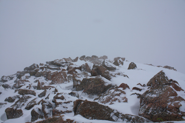 we did just three weeks before and I don't blame them. We were seriously ice crusted and I likely would not have pressed our cause on this trip either had the weather forced me to endure the cold for more than the few hundred vertical feet that we did. Likely the only difference between us and the followers was that we got an earlier start. We crossed the willows and regained the road, surprised to see that the road was now covered with snow but for the wind swept portion right at the pass proper. We mae good time back to the truck but there was at least 3 to 4 inches of fresh snowfall along the length of the road. We arrived back at the car at 3 p.m. and were soon on our way to burgers in Loveland, before driving the final hour to Cheyenne. we did just three weeks before and I don't blame them. We were seriously ice crusted and I likely would not have pressed our cause on this trip either had the weather forced me to endure the cold for more than the few hundred vertical feet that we did. Likely the only difference between us and the followers was that we got an earlier start. We crossed the willows and regained the road, surprised to see that the road was now covered with snow but for the wind swept portion right at the pass proper. We mae good time back to the truck but there was at least 3 to 4 inches of fresh snowfall along the length of the road. We arrived back at the car at 3 p.m. and were soon on our way to burgers in Loveland, before driving the final hour to Cheyenne.
See also climbs of Bierstadt during the summer tourist season, early Fall, and the Sawtooth Ridge . . .
|
