-
Mt. Bierstadt Group Summit - Front Range, Colorado
-
A rest before the summit push on Dallas Peak - San Juan Range, Colorado
-
Broken Ankle + 6 Miles = Tired
-
The classic San Juan approach - San Juan Range, Colorado
-
Overlooking Noname Basin from Twin Thumbs Pass - San Juan Range, Colorado
-
Upper Noname Basin - San Juan Range, Colorado
-
Nearing Noname Cabin - San Juan Range, Colorado
-
Twin Thumbs Twins - San Juan Range, Colorado
-
Nearing the summit of Pt. 13,736 - Sawatch Range, Colorado
-
Blustery day on Iowa Peak - Sawatch Range, Colorado
-
Morning snow at 15k, Cerro Ramada - Cordillera Ramada
-
Artesonraju from the summit of Nevado Pisco - Cordillera Blanca, Peru
-
February crowds on Gray's Peak - Front Range, Colorado
-
Kicking steps on Cerro Lliani - Cordillera Vilcanota, Peru
-
Final traverse to the summit of Wheeler Mountain - Ten Mile Range, Colorado
-
The long walk to Pachanta - Cordillera Vilcanota, Peru
- banner31
Afternoon at 17k on Cerro Ramada - Cordillera Ramada, Argentina
- banner22
The final ridge on Iowa Peak - Sawatch Range, Colorado
-
Summer summit on Longs Peak - Front Range, Colorado
-
A rest day at the Pachanta Hot Springs - Cordillera Vilcanota, Peru
-
Mind over matter on Mt. Parnassas - Front Range, Colorado
-
Rest stop on Cerro Lliani - Cordillera Vilcanota, Peru
- banner30
Post nap surprise on Cerro Ramada - Cordiller Ramada, Argentina
-
Summit on Cerro Lliani - Cordillera Vilcanota, Peru
- banner23
Ridge walking on Grizzly Peak - Sawatch Range, Colorado
-
Enroute the summit via the West Ridge on Pacific Peak - Ten Mile Range, Colorado
-
Mule train bound for Chilca - Cordillera Vilcanota, Peru
-
Taking in the view from Fletcher Peak - Ten Mile Range, Colorado
-
Hiking on Silverheels - Mosquito Range, Colorado
-
Traversing! Gladstone Peak - San Juan Range, Colorado
- banner24
The best of times at Willow Lake - Sangre de Christo Range, Colorado
- banner29
High Altitude Cerebral Edema? - Cordillera Ramada, Argentina
-
Bound for Chilca - Vilcanota Range, Peru
-
Going alpine light, Holy Cross Ridge - Sawatch Range, Colorado
-
Cumbre! Campa I - Cordillera Vilcanota, Peru
-
Roadside lunch with the best of company - Cordillera Vilcanota, Peru
- banner25
Long ridge walk to the summit of California Peak - Sangre de Christo Range, Colorado
- banner28
Crossing el Rio Colorado . . . in the afternoon - Cordillera Ramada, Argentina
- banner37
Dealing with Fall snows high on Casco Peak - Sawatch Range, Colorado
-
Moonrise over Mercedario - Cordillera Ramada, Argentina
-
Still climbing at 20,900 on Cerro Ramada - Cordiller Ramada, Argentina
-
Talus on Halo Ridge, Mt. of the Holy Cross - Sawatch Range, Colorado
- banner26
Deteriorating conditions on Mt. Arkansas - Ten Mile Range, Colorado
- banner27
After the climb - Cordillera Ramada, Argentina
- banner38
Taking in the view from the summit of Crystal Peak - Tenmile Range, Colorado
-
Topping out on Mt. Arkansas' North Couloir - Mosquito Range, Colorado
-
Glissade on Mt. Arkansas - Mosquito Range, Colorado
-
Hard snow morning on Teakettle Mountain - San Juan Range, Colorado
-
Spring snow announces the start of the climb on Dallas Peak - San Juan Range, Colorado
-
Crossing the Eolus Catwalk - San Juan Range, Colorado

 We left Cheyenne at 5 a.m. and picked Ed up in Thornton at a bit before 6:30. On to the usual stop outside of Lakewood on I-70 and then down 285 to Fairplay. The lack of snow in this part of the state was obvious and by that time we were in South Park, it was obvious that while some gullies were holding snow, most of the peaks were wind blown and relatively bare. We exited the hard road just shy of Alma and made our way up the Mosquito Gulch Road. Bob opted to drive so were were in his Honda Accord, in mid December, on a road that should have been snowed in for the winter about six weeks earlier. Not the case, we drove all the way to the summer trailhead and parked.
 The more folks you have the longer it takes to quit lollygagging and get the gear on to start the climb. We left the car at about 9:30 and headed up the road toward Mosquito Pass. The lower slopes were well covered by willows, which appeared to have caught what snow there was and were well drifted in. We hiked up the first leg of the road toward the pass and then cut off to gain the sort of southeast ridge at about the 12,200 foot mark. We willow busted for a bit and then mounted the ridge proper which was above the willow line. We headed generally northwest and caught a segment of road before taking a direct route up the slopes that would lead not quite to the summit but get us to a point on the ridge between Mosquito and Repeater Peaks, but only a hundred or so vertical feet shy of the Mosquito summit.
 The snow was often wind hammered but as we got higher we did find soft areas, each offering a good chance to skin a shin, one of the true rewards of early snow season climbing. We also encountered not quite frozen scree that gave the 3 up and 1 back down slog that is the bane of summer climbing. We eventually cut the ridge and after taking a short water break, we all trudged to the summit proper, perhaps 15 minutes further on. The time was 12:15, we'd been out for about 3 hours to which we added another 15 minutes to eat lunch and debate the trek over to Treasurevault Mountain, a subsidiary peak. The decision was unanimous as to the connection to Treasurevault, so off we went.
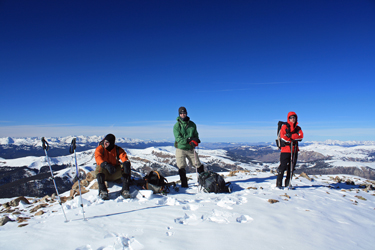 Treasurevault is a subsidiary peak, not having sufficient drop to the intermediate saddle to qualify as a true neighbor to Mosquito Peak. The traverse was quick and interrupted only by a brief glance at the pair of antique air compressors located in the saddle proper. This area of the Mosquito range, has seen heavy mining activity and the slopes bear evidence in the form of road cuts, prospect holes and the assorted items of mining debris that litter the slopes. Soon we were atop Treasurevault and, with but a minute or two of pause, we were heading down the opposite ridge a short distance before cutting down to the valley below.
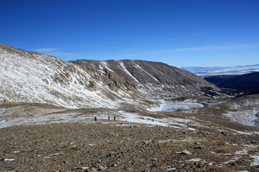 The route to Cooney Lake was a mellow scree descent but for a steeper slope above the lake proper that yielded standing glissades for all takers. The lake was frozen, every bit of six or more inches thick and slick as the green stuff geese leave on the sidewalk. We slid and slipped across the lake surface before dropping down again on the other side to arrive at the top of the slopes overlooking the first segment of the Mosquito pass road and the car located but a few yards back from the start of the 4 WD portion of the road to the pass.