|
||
|---|---|---|
Mount ParnassasApril 17, 2011 - via the Southwest Ridge from Watrous Gulch
I had not seen a summit since scoring New Zealand's Ben Lomond in early March and, after a number of turn backs, Bob, G and I were ready to get out and do some climbing. G unfortunately took a spot on the injured list and sat this weekend out as Bob and I took a shot at Bard Peak. We didn't score Bard but we did manage to summit Parnassas Peak under some trying but not all that out of the ordinary Spring weather conditions.
I took an ambling lead, ambling as I had yet to find my groove and I definitely did not have my talus feet in order. Bob was right behind me as we steadily climbed, mostly in silence and being buffeted to the right by the strong gusts. We climbed on and could see that we would soon cut the ridge line, after which we knew we might or might not see the summit. Views of I-70 were gone at this I set off at a brisk pace as my hands were cold from taking a few photos, wanting only to make that mound of rock and then reverse course for the truck. I arrived at the small promontory to find that it was a false summit and that the true summit was another 200 yards away along the ridge. I crossed a few small snow fields en route and was soon enough at the summit of Mt. Parnassas, still with no indication that Bard We had been favored by the wind direction to this point, as it was from our backs and provided a steady boost in achieving each foot of elevation gain. Now we had to face the wind head on so the balaclava went on and the pace down hill was quick. We re-crossed the short false summit pile and then I picked a route down through the talus, seeking to regain a We soon enough picked our way through the remaining talus and scree before picking up a wind hammered snow field that connected to the snow covered slope from tree line to the Watrous Creek swale. From there on it was hard packed trail and in no more than twenty minutes we were back at the truck, having scored a summit but never having seen the summit we set out to climb.
|

 We picked 5 a.m. as the depart time as an alpine start would not be necessary for the relatively short climb we planned to make. No "real" travel, just the run south to Denver and then an hour west to the Herman Gulch trail head, just shy of the exit off of I-70 for Loveland Pass. This would be a new area for the both of us as our prior climbs in this portion of the Front Range were on the high ground extending from Mt. Evans to Loveland Pass. This time we would be on the other side of the highway and covering some new ground, albeit ground we'd both seen for years during the course of driving I-70.
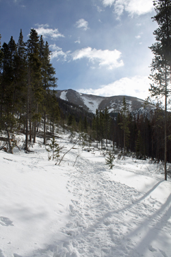
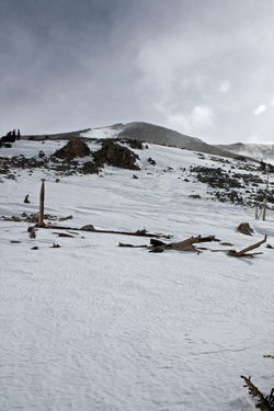 We parked at the Herman Gulch trail head and it was warm . . . the sky was mostly blue . . . and we changed clothes in the open in lieu of the usual contortions that result from changing and putting on boots in the company of the steering wheel or similarly claustrophobic passenger seat. No need this morning, the air was warm and still . . . clearly we'd scored a blue bird day. I wasn't sure what we would find as to snow conditions higher up so I took along the crampons, ice axe, and snow shoes. The trail looked to be a boot packed trench and soon enough we confirmed that to be the case. We passed the first, almost immediate intersection, cut right and walked on toward the Bard Creek trail junction.
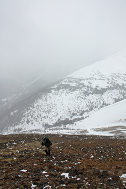 I know there is a Bard Creek trail but we never saw it. The base at Loveland was advertised to be 102 inches, hence the trail and the sign indicating the junction were never seen. I knew we were heading up Watrous Gulch but we had good trail and no flotation issues. I figured to take it for another couple hundred yards past the presumed junction and then cut cross drainage to traverse up to a ridge that looked to offer a rocky ascent toward the summit of Parnassas Peak. The snow proved to have a hard layer no more than 6 inches down and with one exception for Bob, there was not a posthole to be experienced. We cut across the Watrous Gulch drainage and headed crosswise up and over hummocky terrain leading to what looked like a serpentine ridge.
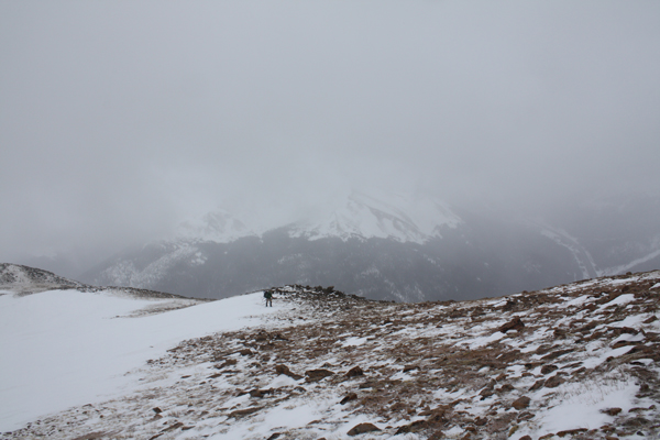
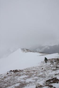 The snow held to form and we swapped the lead about half way to tree line, after which we stopped to access the conditions. The blue skies were gone, the view of the peaks across the highway was fading fast and the soft shell was echoing the soft tic tic of ice pellets hitting the hood. The real issue was not the ice or the visibility but the stiffening wind that drove both factors. The wind had been tame to this point but just before we stopped, we'd both been blown sideways a few times and the gusts were now topping the 50 kph mark. I've been blown down before and told Bob that if the wind got too much stronger, I'd be of a mind to call it a day. We agreed to continue on to a rocky point on the serpentine ridge, after which we would assess the likelihood of gaining the summit.
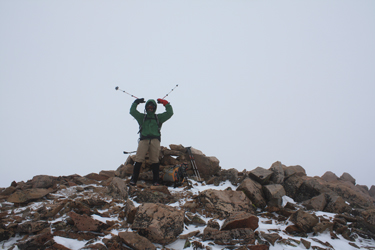 point as was any hope of seeing Torreys or Bard, which we knew were out there somewhere. The ridge came after a bit and seemed to grant us a course to the summit, which we thought was the mound of rock that was a quarter mile away and would require another two hundred feet of vertical to achieve.
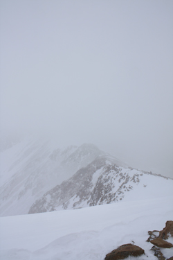 Peak was anywhere in the vicinity. Bob followed a minute or two later and we took enough of a break to shoot a Gu and take a slug of water. The wind was ripping across the summit and neither of us had any interest in a summit stay that would be measured in units greater than seconds.
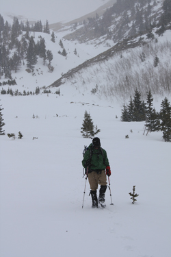 grassy swale that presented a mellow route on the up bound leg. I traversed to the swale and we were soon making good time in our quest to gain no less than 3 Fahrenheit degrees on our thermometers per thousand feet of decrease in elevation. Soon enough, though likely an hour, we were most of the way down and able to take advantage of a brief calm to sit down, eat a snack and adjust the gear.