-
Mt. Bierstadt Group Summit - Front Range, Colorado
-
A rest before the summit push on Dallas Peak - San Juan Range, Colorado
-
Broken Ankle + 6 Miles = Tired
-
The classic San Juan approach - San Juan Range, Colorado
-
Overlooking Noname Basin from Twin Thumbs Pass - San Juan Range, Colorado
-
Upper Noname Basin - San Juan Range, Colorado
-
Nearing Noname Cabin - San Juan Range, Colorado
-
Twin Thumbs Twins - San Juan Range, Colorado
-
Nearing the summit of Pt. 13,736 - Sawatch Range, Colorado
-
Blustery day on Iowa Peak - Sawatch Range, Colorado
-
Morning snow at 15k, Cerro Ramada - Cordillera Ramada
-
Artesonraju from the summit of Nevado Pisco - Cordillera Blanca, Peru
-
February crowds on Gray's Peak - Front Range, Colorado
-
Kicking steps on Cerro Lliani - Cordillera Vilcanota, Peru
-
Final traverse to the summit of Wheeler Mountain - Ten Mile Range, Colorado
-
The long walk to Pachanta - Cordillera Vilcanota, Peru
- banner31
Afternoon at 17k on Cerro Ramada - Cordillera Ramada, Argentina
- banner22
The final ridge on Iowa Peak - Sawatch Range, Colorado
-
Summer summit on Longs Peak - Front Range, Colorado
-
A rest day at the Pachanta Hot Springs - Cordillera Vilcanota, Peru
-
Mind over matter on Mt. Parnassas - Front Range, Colorado
-
Rest stop on Cerro Lliani - Cordillera Vilcanota, Peru
- banner30
Post nap surprise on Cerro Ramada - Cordiller Ramada, Argentina
-
Summit on Cerro Lliani - Cordillera Vilcanota, Peru
- banner23
Ridge walking on Grizzly Peak - Sawatch Range, Colorado
-
Enroute the summit via the West Ridge on Pacific Peak - Ten Mile Range, Colorado
-
Mule train bound for Chilca - Cordillera Vilcanota, Peru
-
Taking in the view from Fletcher Peak - Ten Mile Range, Colorado
-
Hiking on Silverheels - Mosquito Range, Colorado
-
Traversing! Gladstone Peak - San Juan Range, Colorado
- banner24
The best of times at Willow Lake - Sangre de Christo Range, Colorado
- banner29
High Altitude Cerebral Edema? - Cordillera Ramada, Argentina
-
Bound for Chilca - Vilcanota Range, Peru
-
Going alpine light, Holy Cross Ridge - Sawatch Range, Colorado
-
Cumbre! Campa I - Cordillera Vilcanota, Peru
-
Roadside lunch with the best of company - Cordillera Vilcanota, Peru
- banner25
Long ridge walk to the summit of California Peak - Sangre de Christo Range, Colorado
- banner28
Crossing el Rio Colorado . . . in the afternoon - Cordillera Ramada, Argentina
- banner37
Dealing with Fall snows high on Casco Peak - Sawatch Range, Colorado
-
Moonrise over Mercedario - Cordillera Ramada, Argentina
-
Still climbing at 20,900 on Cerro Ramada - Cordiller Ramada, Argentina
-
Talus on Halo Ridge, Mt. of the Holy Cross - Sawatch Range, Colorado
- banner26
Deteriorating conditions on Mt. Arkansas - Ten Mile Range, Colorado
- banner27
After the climb - Cordillera Ramada, Argentina
- banner38
Taking in the view from the summit of Crystal Peak - Tenmile Range, Colorado
-
Topping out on Mt. Arkansas' North Couloir - Mosquito Range, Colorado
-
Glissade on Mt. Arkansas - Mosquito Range, Colorado
-
Hard snow morning on Teakettle Mountain - San Juan Range, Colorado
-
Spring snow announces the start of the climb on Dallas Peak - San Juan Range, Colorado
-
Crossing the Eolus Catwalk - San Juan Range, Colorado

 The weather on the eastern side of the divide was fine but upon our exit from the Eisenhower tunnel, we were greeted with winter . . . not spring, but winter. Lots of snow on the road, a bit of wind and a good bit on snow coming down at a steady rate. John noted that we appeared to have found winter in April. We had anticipated that we would find blowing snow as the forecast did call for a windy day. We also figured we would muscle through. We dropped down Fremont pass and parked at the hairpin turn marking the start of the drainage that forms the headwaters of the Arkansas River.
 We did a presto chango in the Jeep and I noted that although it was snowing it really was not that cold out and there was no significant wind. We hefted the packs and were on our way up the unplowed mine road for a hundred yards before we skipped the turn for the public dirt road and just cut straight across a band of willows to intercept the route a bit further along. We picked up pieces of the road here and there, starting with a stretch of the old rail line and then working our way through willow bands and then hitting the summer road and staying on it for a bit over a mile.
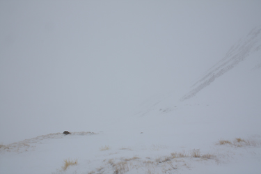 The summer road hugs the base of the valley on the ascender's right side and leads to number of mine structures, one of which offered an opening in a wall sufficient for us to stand inside on a gravel floor and out of the wind. We both took a drink and ate some snacks before again moving onward up the valley. Our plan was to go up valley and then cut to the ascender's right to climb the slopes leading to the Arkansas/Tweto saddle. Given that it is early in the season, we planned to be cautious of the slopes from an avi perspective and really figured that if too much weather or new snow made an appearance, this trip would be reduced to an extended recon for a better day.
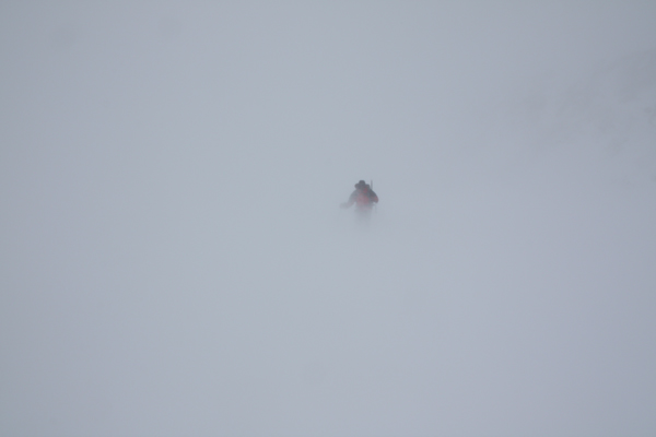
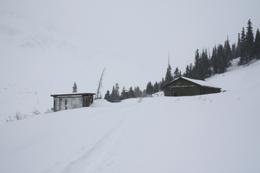
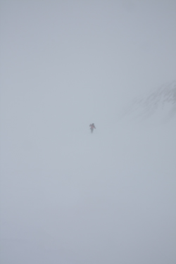 We made a good course through the last copse of trees and then out onto the open area that forms the lowermost slopes of the route up to the saddle. The wind was starting to pick up but every once in a while we would score a glimpse, albeit a very short one, of the sun trying to break through. We climbed to an outcrop and had a pow-wow as the wind had increased substantially and the visibility was notably reduced. There appeared to be a slight spine cutting further upward on the high meadow we had reached and rather than turn the climb, we decided to walk perhaps another 1/4 mile of gently sloping ground just to see what lay beyond. The snow and wind was hard at our backs and neither of us still held any real hope for a summit.
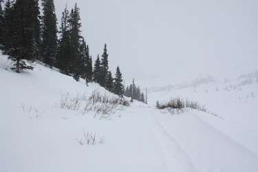 blizzards of fine snow crystals that seem to cut the skin. We lost the better part of 500 feet of elevation from our 12,200 foot high, cut an extended course around a steeper slope that I did not like the looks of and wandered on back to the mid-point mine site. From there we hoofed it, for a while on the remnants of our morning trail to the Jeep, calling it as day after five miles and four hours of winter travel.